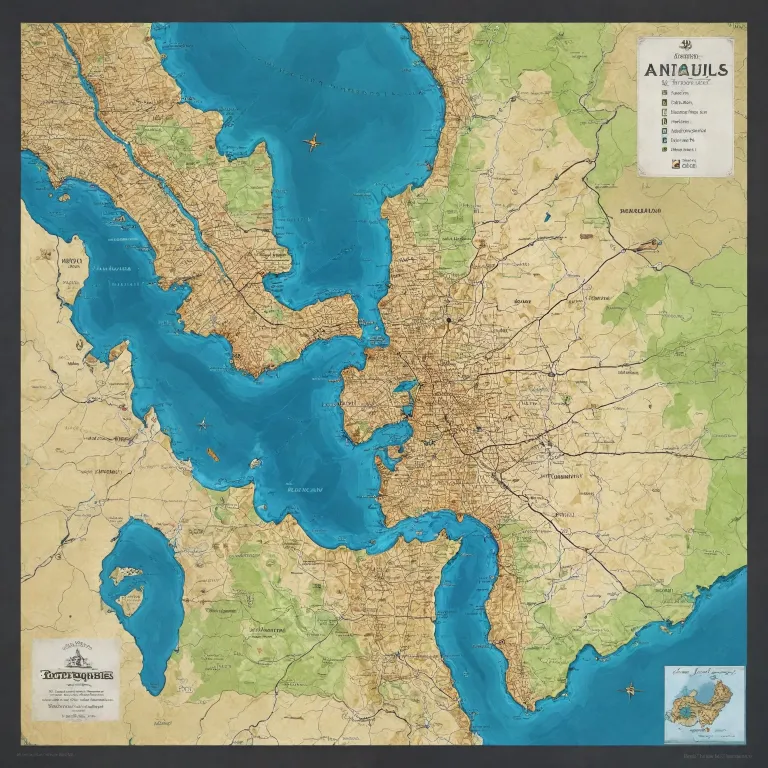
Geographical insights: Navigating the map of Port Angeles, Washington State
Port Angeles, situated on the northern edge of the Olympic Peninsula in Washington State, offers a unique blend of natural beauty and urban development. The map of Port Angeles, Washington State, reveals a city bordered by the Strait of Juan de Fuca to the north and the Olympic Mountains to the south, providing a striking contrast between marine life and mountainous terrain. This geographic diversity shapes the visitor experience, as well as the strategies of local tourism offices, regional agencies, and private actors seeking to promote the area. The city’s deep-water port has historically been a focal point for economic activity, supporting both commercial and recreational marine traffic. The map view highlights key features such as Ediz Hook, a natural spit extending into the strait, and the proximity to Olympic National Park, a UNESCO World Heritage site. Understanding the layout of Port Angeles is essential for optimizing visitor flows, enhancing local service delivery, and supporting sustainable development initiatives. Tourism professionals can leverage the City of Port Angeles' GIS mapping tool to access detailed geographic data, supporting informed decision-making and tailored visitor experiences. The integration of interactive map views and real-time weather updates further enhances the ability to respond to visitor needs and changing conditions. For those planning a visit, the Port Angeles Visitor Center provides physical maps and local insights, ensuring a seamless transition from digital planning to on-the-ground exploration.Key landmarks and attractions: Mapping the experience in Port Angeles
The map of Port Angeles, Washington State, is dotted with landmarks that define the city’s character and appeal. Notable sites include the Clallam County Courthouse, a testament to the area’s civic heritage, and the historic Masonic Temple. The Olympic Discovery Trail offers panoramic views of the Olympic Mountains and the city’s waterfront, making it a must-see for visitors and residents alike. The ferry terminal, operated by Black Ball, connects Port Angeles to Victoria, British Columbia, facilitating cross-border tourism and enriching the local economy. The port area is a hub for marine life observation, with opportunities to spot seals, otters, and a variety of seabirds. The city’s parks, such as those along Ediz Hook, provide accessible green spaces with spectacular views of the strait and the Olympic Peninsula. Local agencies and tourism offices play a crucial role in curating these experiences, ensuring that visitors have access to accurate information and high-quality services. The integration of map views into promotional materials and visitor guides enhances the ability to showcase the city’s assets effectively. For a comprehensive review of the area’s attractions, stakeholders can consult the Visit Port Angeles platform, which offers up-to-date information on events, weather, and visitor services. For further insights into the city’s development and planning initiatives, explore the Clallam County GIS Portal, a valuable resource for understanding land use patterns and infrastructure projects.Strategic value of mapping for tourism offices and regional agencies
For tourism offices, agencies of development, and local authorities, the map of Port Angeles, Washington State, is more than a navigational tool—it is a strategic asset. Accurate mapping supports the coordination of visitor services, the management of high-traffic areas, and the promotion of lesser-known attractions. The city’s unique geography, with its blend of urban, marine, and mountainous environments, requires a nuanced approach to destination management. Interactive GIS tools enable stakeholders to monitor visitor flows in real time, adjust service delivery, and identify emerging trends. The ability to overlay demographic data, such as information from the United States Census, with geographic features allows for targeted marketing and resource allocation. As stated in the dataset, "Utilize the City of Port Angeles' interactive GIS mapping tool for detailed navigation." This approach enhances the visitor experience while supporting sustainable growth and environmental stewardship. Regional agencies can also leverage mapping data to foster cross-border collaboration, particularly in relation to the ferry connection with British Columbia and the shared stewardship of the Strait of Juan de Fuca. The integration of weather data, park information, and marine life observation points into digital maps further enriches the value proposition for visitors and local stakeholders. For a deeper understanding of the city’s infrastructure and planning context, consult the City of Port Angeles official website.Enhancing visitor experience through digital and physical map resources
The visitor experience in Port Angeles is shaped by the availability and quality of map resources, both digital and physical. The City of Port Angeles GIS Mapping Tool offers a comprehensive map view, allowing users to explore the city’s neighborhoods, parks, and waterfront areas in detail. This digital platform is complemented by physical maps available at the Port Angeles Visitor Center, ensuring accessibility for all types of travelers. The integration of real-time weather updates, ferry schedules, and local service information into digital maps empowers visitors to plan their itineraries with confidence. The Olympic National Park, a major draw for tourists, is prominently featured on the map of Port Angeles, Washington State, highlighting key access points and trailheads. The area’s diverse marine life and scenic views are also mapped, guiding visitors to the best vantage points along the waterfront and Ediz Hook. Tourism offices and regional agencies can enhance the visitor journey by providing curated map-based guides, tailored to different interests such as hiking, marine observation, or cultural heritage. The use of map views in promotional campaigns and event planning supports the city’s reputation as a gateway to the Olympic Peninsula and the broader United States Pacific Northwest. For those interested in the city’s historical evolution, historical maps are accessible through the Library of Congress and local archives. For more information on the Olympic Discovery Trail and its scenic routes, visit the official trail website.Data-driven decision making: Leveraging mapping tools for sustainable development
The map of Port Angeles, Washington State, serves as a foundation for data-driven decision making among tourism professionals, local authorities, and private sector partners. By integrating demographic, environmental, and economic data into map views, stakeholders can identify opportunities for growth and address challenges related to infrastructure, service delivery, and environmental conservation. The city’s population, recorded at 19,960 according to the United States Census, and its total area of 14.53 square miles, provide a framework for understanding the scale and scope of development initiatives. Mapping tools enable the visualization of land use patterns, transportation networks, and key service areas, supporting the efficient allocation of resources. The review of visitor flows, weather patterns, and seasonal trends informs the planning of events, marketing campaigns, and infrastructure projects. Local agencies can also use mapping data to monitor the health of marine life populations, track changes in park usage, and assess the impact of tourism on the Olympic National Park and surrounding areas. The integration of real-time data into map views enhances the ability to respond to emerging issues and capitalize on new opportunities. For a comprehensive overview of the city’s mapping resources, consult the City of Port Angeles GIS Mapping Tool.Collaborative opportunities: Engaging stakeholders through mapping innovation
Collaboration among tourism offices, regional agencies, elected officials, and private actors is essential for maximizing the value of the map of Port Angeles, Washington State. The integration of mapping tools into public engagement initiatives fosters transparency, accountability, and community involvement. As highlighted in the dataset, "Visit the Port Angeles Visitor Center for physical maps and local insights." This approach ensures that all stakeholders have access to accurate, up-to-date information, supporting informed decision making and shared stewardship of the city’s assets. Innovative mapping solutions, such as interactive GIS platforms and mobile applications, enable real-time communication and coordination among partners. The ability to share map views, review service delivery, and monitor visitor feedback enhances the effectiveness of regional development strategies. The inclusion of marine life observation points, park amenities, and weather updates in digital maps supports the city’s positioning as a premier destination for outdoor recreation and eco-tourism. Stakeholders are encouraged to participate in ongoing mapping initiatives, contribute local knowledge, and collaborate on the development of new tools and resources. The partnership between the City of Port Angeles, Clallam County, and Visit Port Angeles exemplifies the benefits of coordinated action and shared investment in mapping innovation. For more information on collaborative mapping projects, visit the Clallam County GIS Portal.Quantitative insights: Key statistics on Port Angeles and its mapping landscape
- Population (2020 Census): 19,960 people
- Total area: 14.53 square miles
- Land area: 10.71 square miles
- Water area: 3.82 square miles
Frequently asked questions about the map of Port Angeles, Washington State
Where can I find detailed maps of Port Angeles?
Detailed maps are available through the City of Port Angeles' official website and GIS mapping tool.
What are some notable landmarks in Port Angeles?
Notable landmarks include the Clallam County Courthouse, Masonic Temple, and the natural deep-water harbor.
How can I access historical maps of Port Angeles?
Historical maps can be accessed through the Library of Congress and other archival resources.
What resources are available for understanding land use and planning in Port Angeles?
The Clallam County GIS Portal and the City of Port Angeles GIS Mapping Tool provide comprehensive data on land use, infrastructure, and development projects.